The Keweenaw Peninsula has thousands of acres of remote, forested wilderness and miles of Lake Superior shoreline. Hiking is one of the best ways to explore the wooded paths, nature trails, mountain top summits and rocky shorelines.
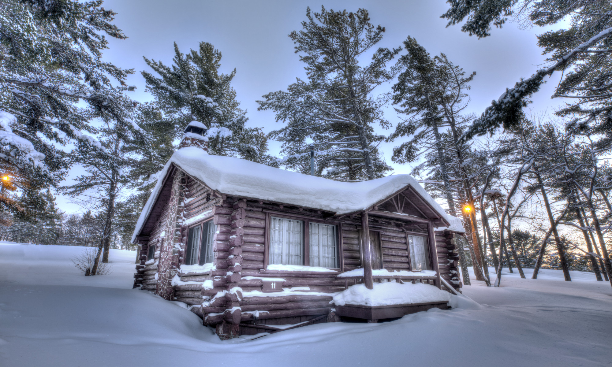
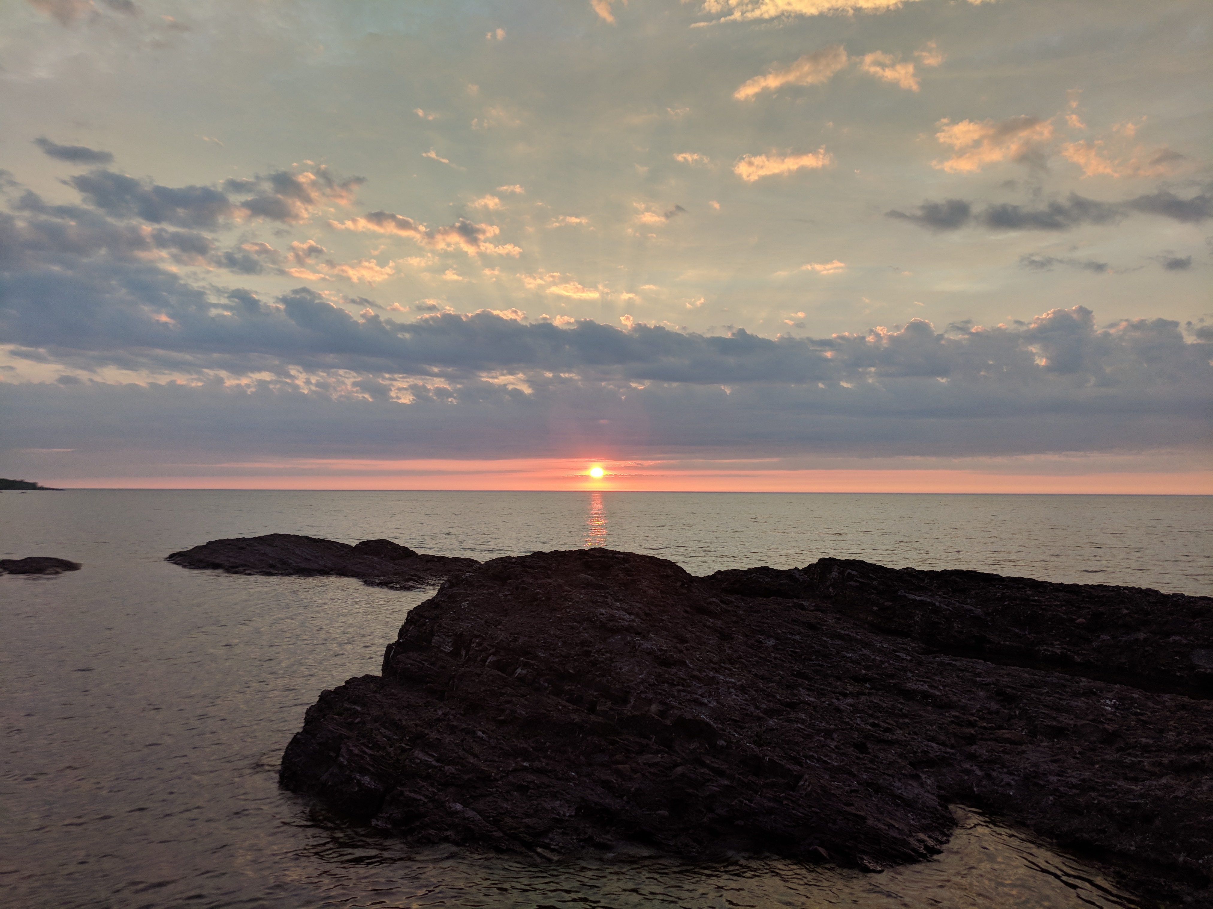
The Lodge and its cabins serve as a jumping off point for a variety of trail systems throughout the Peninsula. Enjoy old growth pine forests, waterfalls, and stunning beaches with sunsets over Lake Superior, all within easy reach of our doors.
Here are several suggested hikes that you can take when you are at the Lodge:
Sightseeing Hike | Dancing Bear Hike | Here We Go! Hike
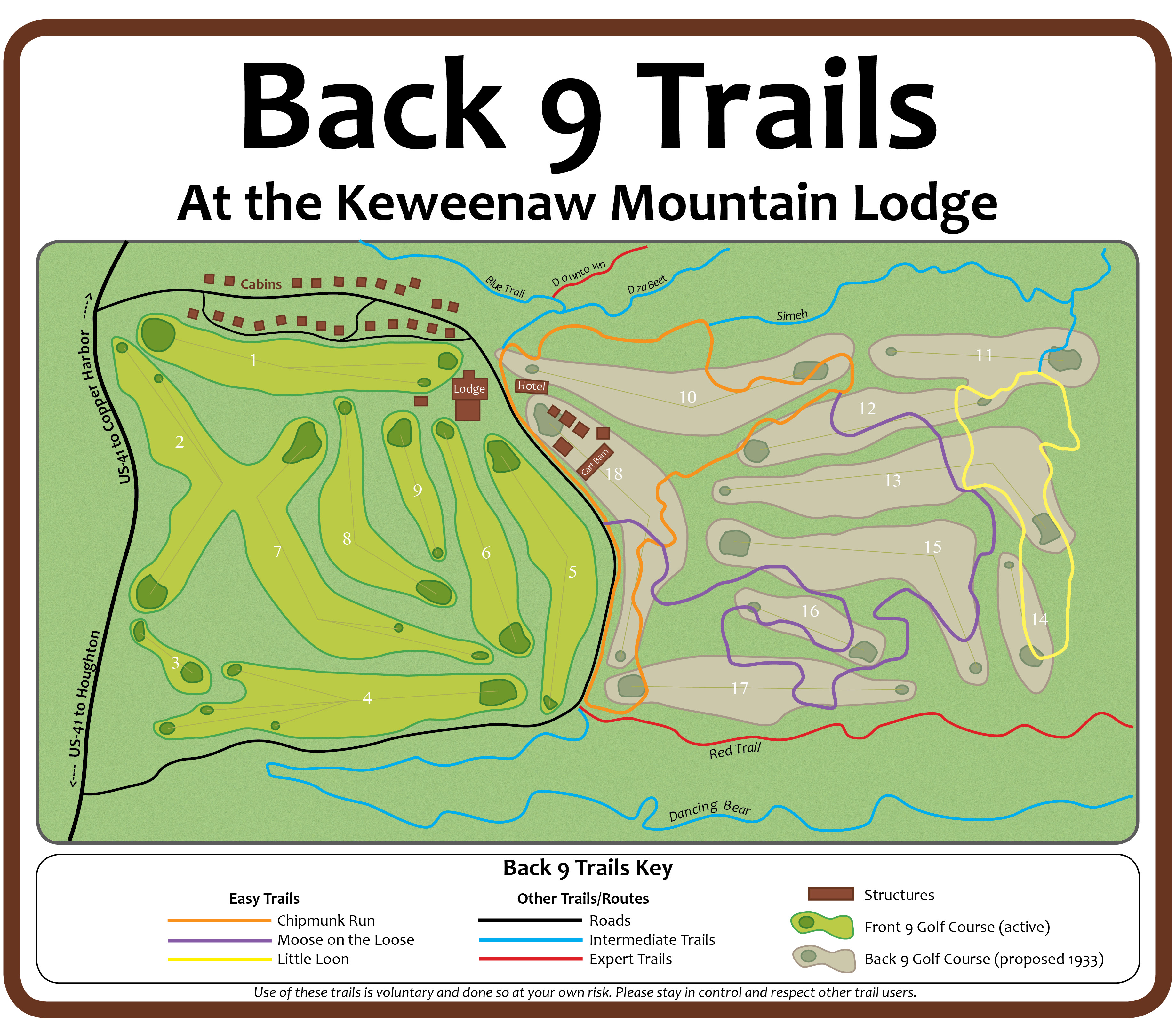
Below is a map of the trails located near the Lodge and cabins. These trails are literally right out the door of the cabins. The other map is of the whole Copper Harbor Trail System.
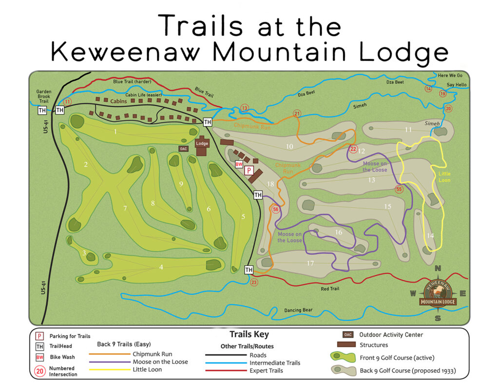
[ click on image above to see a larger view of the trail map ]
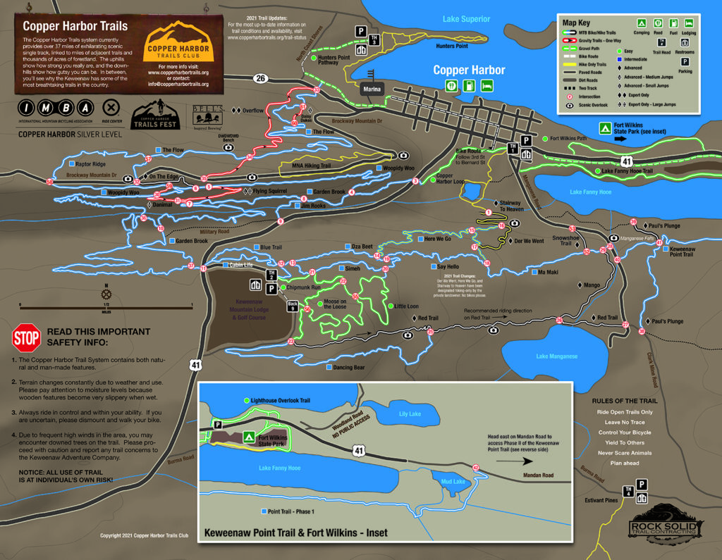
[ click on image above to see a larger view of the trail map ]
 One of the best guides to take with you when you explore the Keweenaw on foot is the Walking Paths & Protected Areas of the Keweenaw (3rd Edition). This guide can be purchased at the Lodge or in gift shops, outfitters, and visitors’ centers throughout the Keweenaw. You can also learn more about the book and order it directly from the Michigan Nature Association.
Walking Paths features 27 publicly accessible nature and wildlife sanctuaries, preserves, and parks located in Houghton and Keweenaw Counties. Each entry includes natural history information, trail descriptions and maps, level of difficulty, distances, and directions.
Check out the following hikes from Walking Paths that are easily accessible from the Lodge. Each of the hikes spotlight the rugged, natural beauty of the Keweenaw-refer to the guidebook for additional detail and other great hikes!
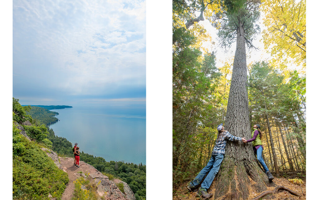
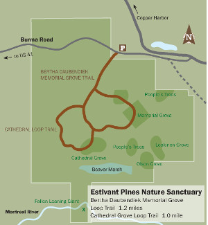 Estivant Pines (Moderate Difficulty): The Estivant Pines make up the largest tract of old growth Eastern White Pine preserved in Michigan, containing hundreds of 300-year old white pine measuring 3-5 feet in diameter. The dense old growth forest canopy provides habitat for 85 species of birds, 23 species of ferns and a wide variety of understory plants. The trail is divided into two loops, 3 miles roundtrip. (Protected by the Michigan Nature Association)
Estivant Pines Trailhead: Head north from the Lodge on US 41 to the blinker light in Copper Harbor, continue east on US 41. Turn right onto 2nd Street at the Community Center (note sign for Manganese Lake). Follow 2nd Street (also called Manganese Road) for 1.2 miles, bearing left onto Clark Mine Road. Travel 1.2 miles and turn right on Burma Road (look for signs for Estivant Pines). Travel another 0.65 miles to the parking area on the right or the trailhead and additional parking on the left.
[ Download the Estivant Pines Hiking Trail Map ]
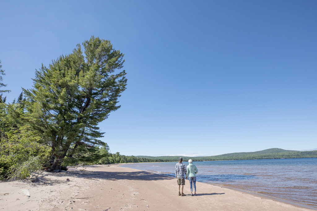
Hunter’s Point Park (Moderate Difficulty): The two trails offer many scenic overlooks and provide access to nearly one one-half mile of picturesque rocky beaches just outside of Copper Harbor. The North Shore Trailhead is 0.9 mile and the South Shore Trail is 1.25 miles. (Protected by the Grant Township)
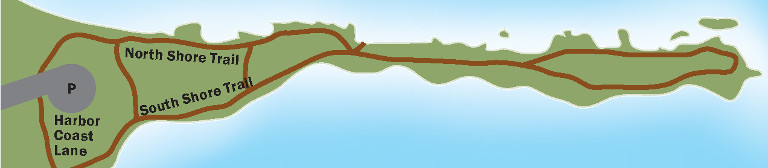
North Shore Trailhead: Head north from the Lodge on US 41 to the blinker light in Copper Harbor. At the blinker, drive west on M-26 about 0.7 mile (0.3 mile past the Copper Harbor Marina) and turn right onto North Coast Shores Road. Drive north to Harbor Coast Lane and turn right; drive 0.3 mile to the main parking area and trailhead.
South Shore Trailhead: From the blinker light in Copper Harbor at the intersection of M-26 and US-41, drive west on M-26 about 0.4 mile and turn right into the Copper Harbor Marina. Please park in the first parking lot on your right. The trail begins to the left (west) of the boat launch ramp.
[ Download the Hunter’s Point Park Hiking Trail Map ]
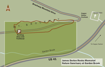 James Dorion Rooks Memorial Nature Sanctuary at Garden Brook (Easy to Moderate Difficulty): The sanctuary extends along both sides of Brockway Mountain Drive close to the “nose” of Brockway Mountain. The trail is a one mile loop through rolling terrain and, on the south of Brockway Mountain Drive, it follows along a spectacular precipice with views of Lake Fanny Hooe, Copper Harbor, and Lake Superior beyond. (Protected by the Michigan Nature Association)
Rooks Trailhead: Head north from the Lodge on US 41 to the blinker light in Copper Harbor. Turn west onto M-26. Travel about a mile and turn left onto Brockway Mountain Drive. Drive one-half mile east on Brockway Mountain Drive. Look for the Michigan Nature Association sign and park at the parking area to the north of the Drive.
[ Download the James Dorion Rooks Hiking Trail Map ]
James H. Klipfel Memorial Nature Sanctuary at Brockway Mountain (Moderate Difficulty): This 160-acre sanctuary includes a half mile of Brockway Mountain Drive and one of the most popular overlooks along the Drive. A short, 0.75 mile loop trail offers a breath-taking view looking north over Lake Superior. A new 0.2 mile connector trail joins a 0.9 mile loop trail within the adjacent John J. Helstrom Nature Sanctuary. (Protected by the Michigan Nature Association)
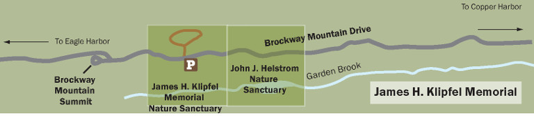
Klipfel Loop Trailhead: Head north from the Lodge to the blinker light in Copper Harbor. Turn west onto M-26. Travel about a mile and turn left onto Brockway Mountain Drive. Drive another 3 miles west to the trailhead marked by the Michigan Nature Association sanctuary sign on the right side of the road.
[ Download the James Klipfel Hiking Trail Map ]
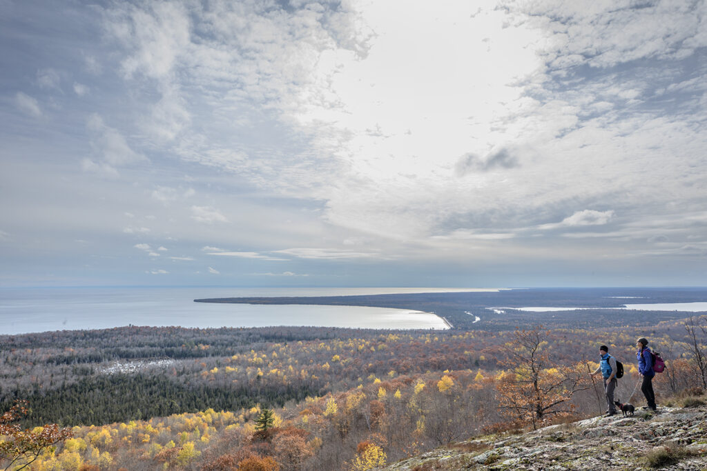
Helmut and Candis Stern Preserve at Mt. Baldy (Difficult): Locally referred to as “Mt. Baldy” or “Lookout Mountain” for its spectacular views of Lake Superior and the Keweenaw Peninsula, this preserve contains one of the largest and least disturbed of only a handful of balds (a natural community) remaining in the Peninsula. The 6-mile, roundtrip trail (out and back) is a steady, uphill climb. (Protected by The Nature Conservancy)
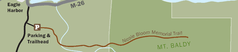
Mt Baldy Trailhead: Head north from the Lodge to the blinker light in Copper Harbor. Travel east on US 26 to Eagle Harbor, about 14 miles. At the point where US 26 makes a 90 degree right turn north into the village of Eagle Harbor, turn left on the Eagle Harbor Shortcut Road. Drive 0.3 mile and turn left onto a gravel two-track next to the large preserve sign marking the access road into the preserve. You are now on Eagle Harbor Township property. Follow signs to gravel parking area at the sandpit located about 1,000 feet off the Eagle Harbor Shortcut Road. Please park in the established parking area.
[ Download the Nicole Bloom Hiking Trail Map ]
Always be prepared!! Wear sturdy boots or shoes; bring plenty of water, snacks, and extra clothes for rapid changes in weather. Biting insects can be bothersome at certain times of year –long sleeves, long pants and repellant can help. Cell phone coverage is limited or non-existent and emergency rescue may be hours away.